If you are selling land in Rentz, you already know it is a different kind of sale. Buyers are not picturing furniture layouts or paint colors. They want fast, clear answers about the tract itself, what it can support, and what records back it up. This guide walks you through how a strong acreage listing gets marketed in Rentz and what helps your property stand out from day one. Let’s dive in.
Why Rentz land marketing is different
Rentz sits on GA 117 in southern Laurens County, about 4 miles southwest of U.S. 441 and about 4 miles northeast of Cadwell. In a market like this, buyers tend to focus on the land’s layout, access, utility availability, and build potential rather than the kind of presentation that matters most for a house.
That is why acreage marketing in Rentz is more documentation-heavy than staging-heavy. The goal is to help buyers understand the tract quickly and confidently before they ever schedule a visit.
What buyers want to know first
When someone looks at a land listing in Rentz, they usually start with practical questions. If your listing answers those questions up front, you can reduce confusion and attract better-qualified interest.
The most important details often include:
- Total acreage
- Road frontage
- Access type
- Utility availability
- Septic or soil considerations
- Flood or wetland flags
- Survey status
- Timber value or lease income, if applicable
These details help a buyer decide whether the tract fits their goals. They also help prevent wasted time later in the process.
Start with accurate property records
A strong land listing begins with accurate, current information. In Laurens County, property details should line up with current public records, and a current survey can be especially helpful when available.
The county assessor notes that property information reflects the most current published tax digest, and appraisal staff may visit and photograph properties as needed. For you as a seller, that makes it even more important to confirm acreage, frontage, and any improvements before the listing goes live.
Use maps to tell the story
For land in Rentz, maps do a lot of the heavy lifting. A buyer can learn far more from a clean aerial with parcel boundaries than from a few standard ground photos alone.
Laurens County GIS includes parcel boundaries, roads, easements, fire districts, school districts, watershed districts, wetlands, flood zones, contours, and soils. That makes map-based marketing one of the most useful tools for showing shape, access, and possible constraints in a way buyers can understand right away.
Best map visuals for acreage listings
The strongest listing packages often include:
- Aerial images with parcel outlines
- Road frontage maps
- Clearly marked access points
- Nearby road references
- Visible improvements, if any
- Flood or wetland context when relevant
This kind of visual package helps buyers get oriented before they visit. It also helps your listing stand out in online search results where first impressions matter.
Show what can be done with the land
Many acreage buyers are asking a simple question: What can I actually do with this property? Your marketing should answer that with facts, not guesses.
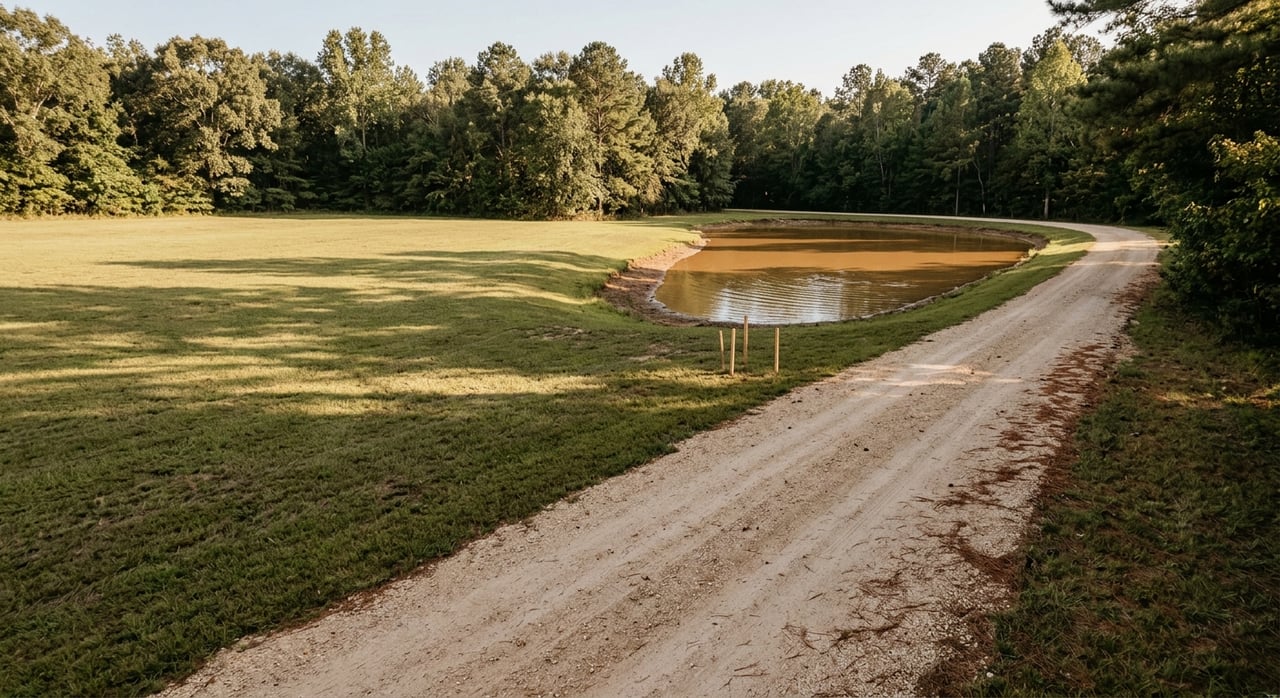
In Rentz, that often means showing whether the tract may work for a homesite, hobby farm, timber use, or future division. The more clearly your listing explains the land’s physical features and known records, the easier it is for buyers to evaluate next steps.
Soil and septic details matter
NRCS soil surveys can help evaluate septic absorption fields, foundations, flooding, water tables, crop and forage production, and tree suitability. If your property could appeal to buyers planning a home, small farm, timber tract, or long-term investment, soil information can add real value to the listing package.
Even a simple soil summary can help a buyer ask better due diligence questions. That can lead to more serious interest and fewer surprises under contract.
Flood and wetland visibility matters too
If part of a tract touches a mapped flood area, that should be easy for buyers to see. Georgia EPD states that Flood Insurance Rate Maps are updated on a countywide basis for all 159 counties, so mapped flood information should be treated as an important part of acreage marketing.
When flood or wetland areas are shown clearly in the marketing packet, buyers can evaluate usable land more realistically. That kind of transparency helps build trust.
Explain access and frontage clearly
Access can make or break a land sale. A tract may look appealing on paper, but buyers still need to know how they reach it and how the frontage works.
That is why your listing should clearly state whether the property fronts a public road, how much frontage it has, and whether any easements affect access. If the tract has a shape or layout that is harder to understand, a labeled map becomes even more important.
Address utilities early
In a rural market, utility questions often come up quickly. Buyers want to know what is available nearby and what may require further verification.
The Laurens County comprehensive plan notes local water and sewer service to Southwest Laurens Elementary, Progressive Rural Telephone Co-Op service, and a Class 4 ISO fire rating in the Rentz area. For a specific tract, your listing should share only the utility details that can be confirmed for that property and avoid broad assumptions.
Clarify subdivision and tax details
Some land buyers are thinking beyond one homesite. They may want to know whether a tract could be divided later or whether there are special tax considerations tied to the property.
Laurens County’s subdivision ordinance applies to unincorporated land and treats a division of 3 or more lots as a subdivision. It also excludes certain no-new-road splits that abut a county road, parcels of 25 acres or more, and immediate-family transfers. If your land could raise these questions, your marketing should present the facts clearly and encourage buyers to do their own due diligence.
Tax status can affect buyer interest
Georgia property tax is based on 40 percent of fair market value. Laurens County also states that conservation-use and forest-land-protection applications are filed with the Tax Assessors’ office between January 1 and April 1.
If your acreage has a preferential tax classification, that status should be checked and disclosed clearly. Buyers will want to understand whether any current classification applies and whether it may affect future ownership decisions.
Why broad exposure matters for Rentz acreage
Land often needs a wider buyer pool than a typical in-town home listing. The right buyer may live in Laurens County, another part of Georgia, or outside the immediate area entirely.
That is where a digital-first marketing approach matters. Grand Real Estate is based in Dublin and serves the surrounding area and beyond, which helps expand visibility for acreage listings that need broader reach.
What a strong marketing campaign looks like
According to Grand Real Estate’s Seller’s Guide, listing exposure is driven through social media campaigns, agent-to-agent referrals, traditional media, and SEO, with the biggest push in the first three weeks after launch. For land in Rentz, that early momentum is especially important because buyers often scan new listings quickly and compare tract details side by side.
A good campaign does more than put the property online. It presents the land in a searchable, easy-to-understand format with strong visuals, accurate facts, and clear positioning.
How Grand Real Estate helps market acreage
Grand Real Estate already supports land search through a dedicated land filter and has presented acreage in a web-friendly format, including larger tract examples. That matters because land should not be marketed like an afterthought.
For you as a seller, that means your property can be positioned with both local knowledge and modern digital reach. In a market like Rentz, that combination can help your listing connect with buyers who are serious about acreage and want real information before they act.
What sellers can do before listing
If you want your land listing to launch strong, preparation matters. The cleaner your information is on day one, the more confidence you give buyers.
Here is a practical pre-listing checklist:
- Confirm current acreage
- Gather any existing survey
- Verify road frontage and access
- Note visible improvements
- Check available utility information
- Review flood or wetland flags
- Gather soil or septic information if available
- Identify timber value or lease details if they apply
- Confirm whether any tax classification is in place
This kind of preparation supports a smoother marketing process. It also helps your listing answer the questions that matter most in the Rentz land market.
If you are thinking about selling land or acreage in Rentz, the right strategy starts with clear facts, strong visuals, and broad exposure. To build a smart plan for your property, connect with Grand Real Estate.
FAQs
What information should a Rentz land listing include?
- A strong Rentz land listing should include acreage, road frontage, access type, utility availability, septic or soil notes, flood or wetland flags, survey status, and any timber or lease income details.
Why are maps so important for acreage marketing in Rentz?
- Maps help buyers understand parcel shape, road access, easements, contours, wetlands, flood zones, and other features that are hard to explain with photos alone.
Do subdivision rules matter when selling land in Laurens County?
- Yes. Laurens County applies subdivision rules to unincorporated land, and certain tract splits may fall under the ordinance depending on the number of lots, road access, and parcel size.
Should a seller disclose flood or wetland areas on Rentz acreage?
- Yes. If a tract touches a mapped flood area or has wetland concerns, showing that clearly in the listing package helps buyers evaluate the property more realistically.
Can soil information help market land in Rentz?
- Yes. Soil survey information can help buyers assess septic suitability, foundations, water tables, flooding concerns, and potential land uses such as homesites, hobby farming, or timber use.